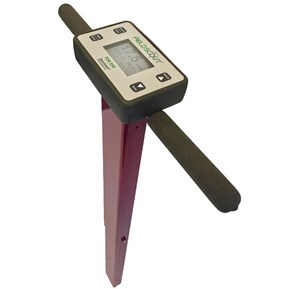
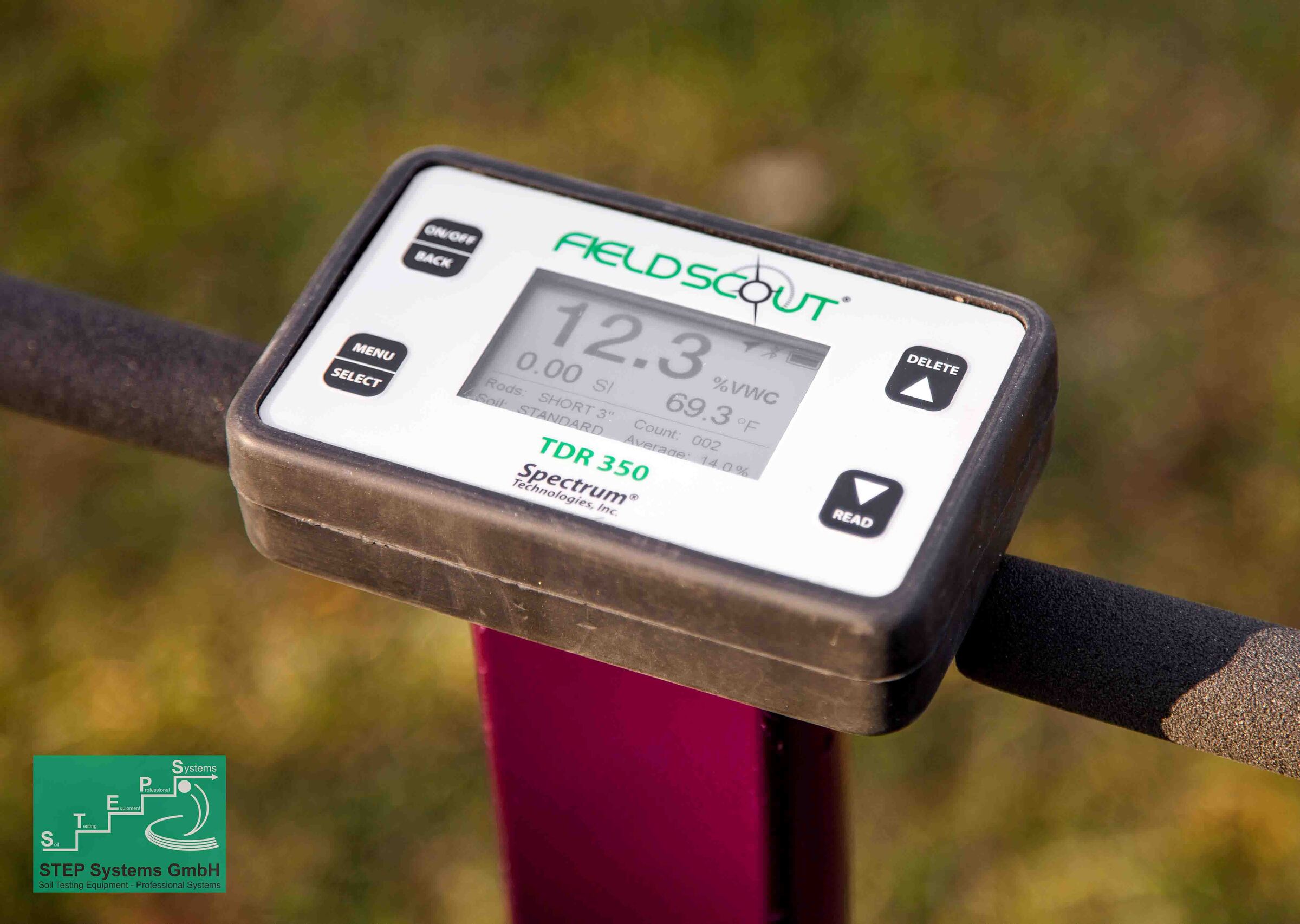
Cart 0

Spectrum TDR 350 Soil Moisture Meter (complete with case) EC Turf Surface Temperature Bluetooth GPS

RM 9,045.00

Offering the proven time-domain measurement technology you have come to recognize for more than 30 years, the TDR 350 accurately measures soil moisture across the full range of soil conditions. Improved ergonomic design provides quick and easy measurements. Validate your cultural practices with hands free data collection integrated with Bluetooth and GPS.


Increased accuracy of soil moisture (Volumetric Water Content)

Measures EC (Electrical Conductivity)

Measures Turf Surface Temperature

Integrated Bluetooth and GPS

Data logger records approximately 50,000 measurements

Industry exclusive backlit display

Improved shaft-mounted probe with telescoping tubular frame

Data collected with USB flash drive

No PC interface needed

Powered by AA lithium batteries

Compatible with SpecConnect and FieldScout App

Optional IR Temp sensor to measure turf canopy

This product is warranted to be free from defects in material or workmanship for two years from the date of purchase.

Bluetooth_Enabled


FieldScout_Mobile_Logo


Manage with the FieldScout Mobile App


Use the FieldScout Mobile app to instantly collect and display data. Collects data from the new

FieldScout® TDR 350 Soil Moisture Meter using Bluetooth Smart connection.

Visualize real-time readings on a Bluetooth Smart Ready smartphone or tablet in the field

• Color coded to represent a scale of moisture, EC, surface temperature or turf firmness

• E-mail relevant information to communicate results with others

• Free download from Apple App Store or Android Google Play


Pro Mode requires a SpecConnect subscription


• Google Maps dynamic satellite image shows readings data overlaid on your property

• Guided Mode allows for taking grid readings without interacting with the phone

• Freeform Mode plots a point for each reading, and stores its data independently

• Automatic wireless upload to SpecConnect for further analysis from your personal web portal

• Eliminates the need for a computer, cable and GPS accessory

• SpecConnect provides complete data overview at once, overlaid on a satellite map

• Color Gradient Mapping of data points within custom selected areas or groupings

• Export your data from SpecConnect into an Excel document for deeper analysis